
Finding the Invisible Rivers | Episode 1: The Momozono River
Exploring the "Invisible Rivers" of Nakano
Over the coming installments, we’ll go on an “exploration” of Nakano Ward together. The Japanese word tanken (探検) means venturing into unknown places to discover things — and while this is no Amazon or Grand Canyon, that’s exactly the point. Extraordinary discoveries hide in the most ordinary everyday scenery. Once you find them, a landscape that seemed black-and-white suddenly bursts into full colour.
What we’re exploring here are rivers — specifically, invisible rivers. The well-known waterways of Nakano include the Myoshoji River, its tributary the Ekoda River, the Kanda River, and the Zenpukuji River. But if you count the invisible ones, there are far more, scattered all around the ward.
These invisible rivers are called ankyo (暗渠) — culverted streams. Some were converted into sewage pipes and now flow underground. Others were filled in entirely, their water gone, their spirit sleeping beneath the soil. Possibly right under your feet, right now.
No travel gear needed. Come as you are — sandals are fine. Let’s go find the invisible rivers.
Nakano's Most Recognisable "Invisible River"
For this first episode, we start with the easiest: the Momozono River.
The bold line indicates the Momozono River Greenway within Nakano Ward.
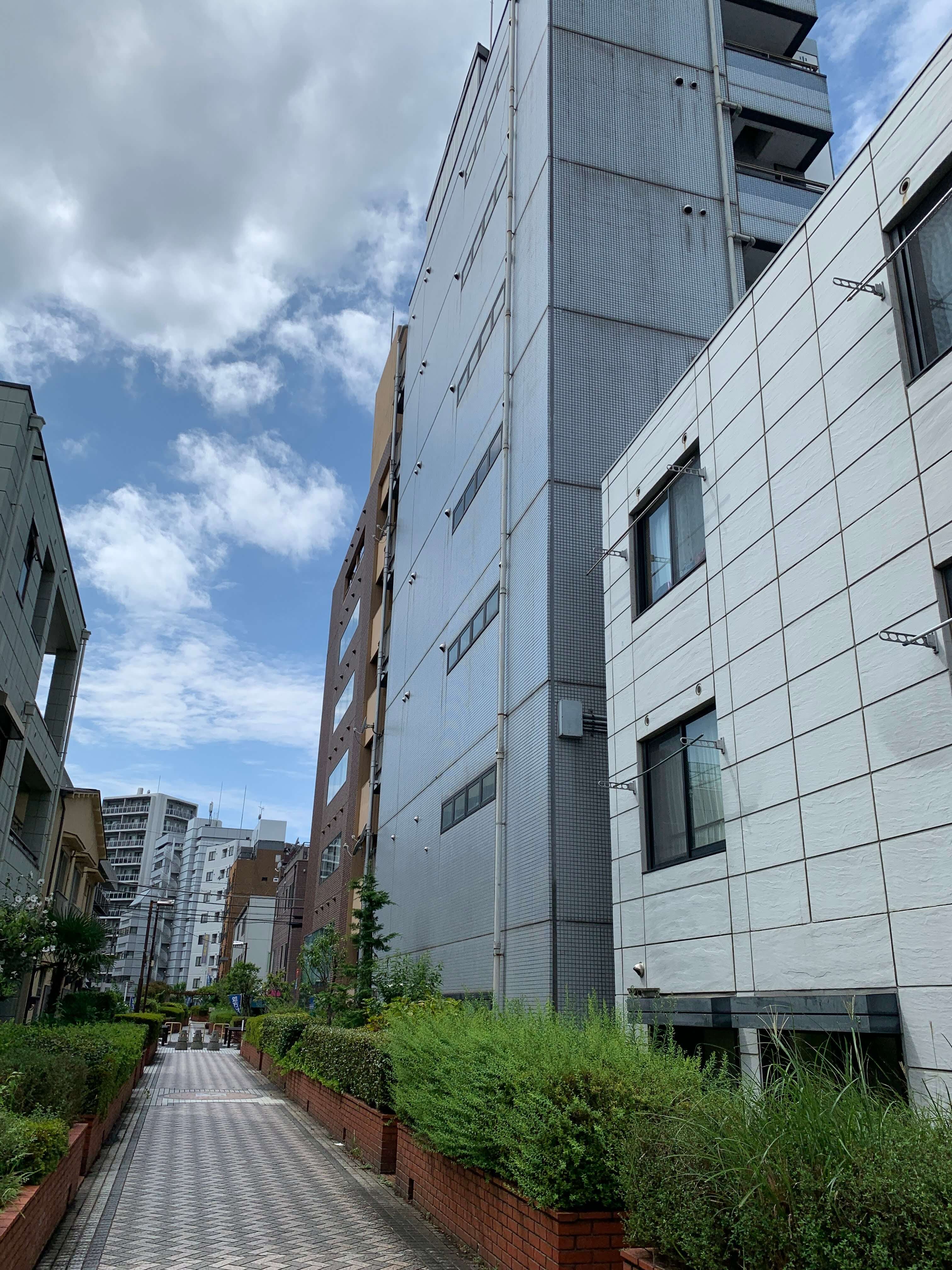
The Momozono River originates near Ogikubo in Suginami Ward, gathers several tributaries, enters Nakano Ward at Nakano 3-chome, then flows roughly parallel to Okubo-dori before joining the Kanda River. It was mostly culverted in the 1960s and is now entirely invisible along its full length.
Within the ward, its route has become the Momozono River Greenway — and the fact that the greenway carries the river’s own name is the main reason it’s the most recognisable starting point.
Urban greenways in Tokyo are often built over culverted rivers. During the high-growth era, many small and medium rivers disappeared — not erased, but moved underground as sewage infrastructure. The narrow strip of land left on the surface was repurposed as parks, bicycle parking, and greenways. (In such cases, the underground pipe falls under Tokyo Metropolitan Government management, while the surface strip belongs to the local ward.)
So whenever you spot a greenway in Tokyo, it’s worth wondering: could this be a culvert?
Clues Along the Momozono River
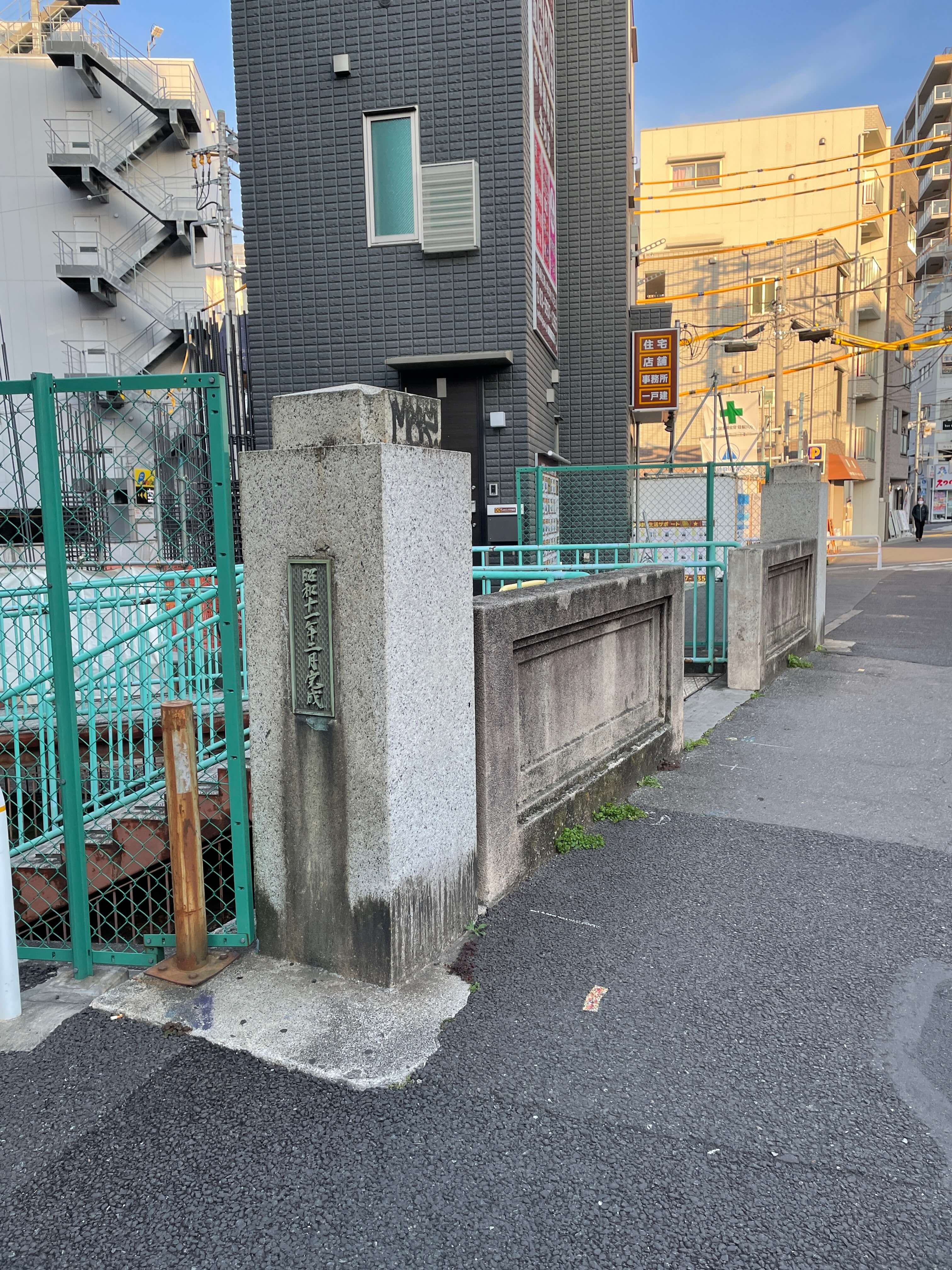
The Momozono River offers plenty of easy-to-spot clues. The first: bridge remnants. It may seem strange to find a bridge where there’s no water, but these are important signs that a river once flowed here. Along the Momozono River greenway in Nakano, nearly every road crossing has a bridge remnant — and while the original structures are mostly gone, the ward has installed named monuments in their place. Nakano is a ward that treats its bridge remnants with care.
Another easy-to-spot clue is the bollards placed alongside bridge remnants. Bollards are those familiar fixtures you often see at park entrances or building driveways — the ones designed to stop vehicles from entering.
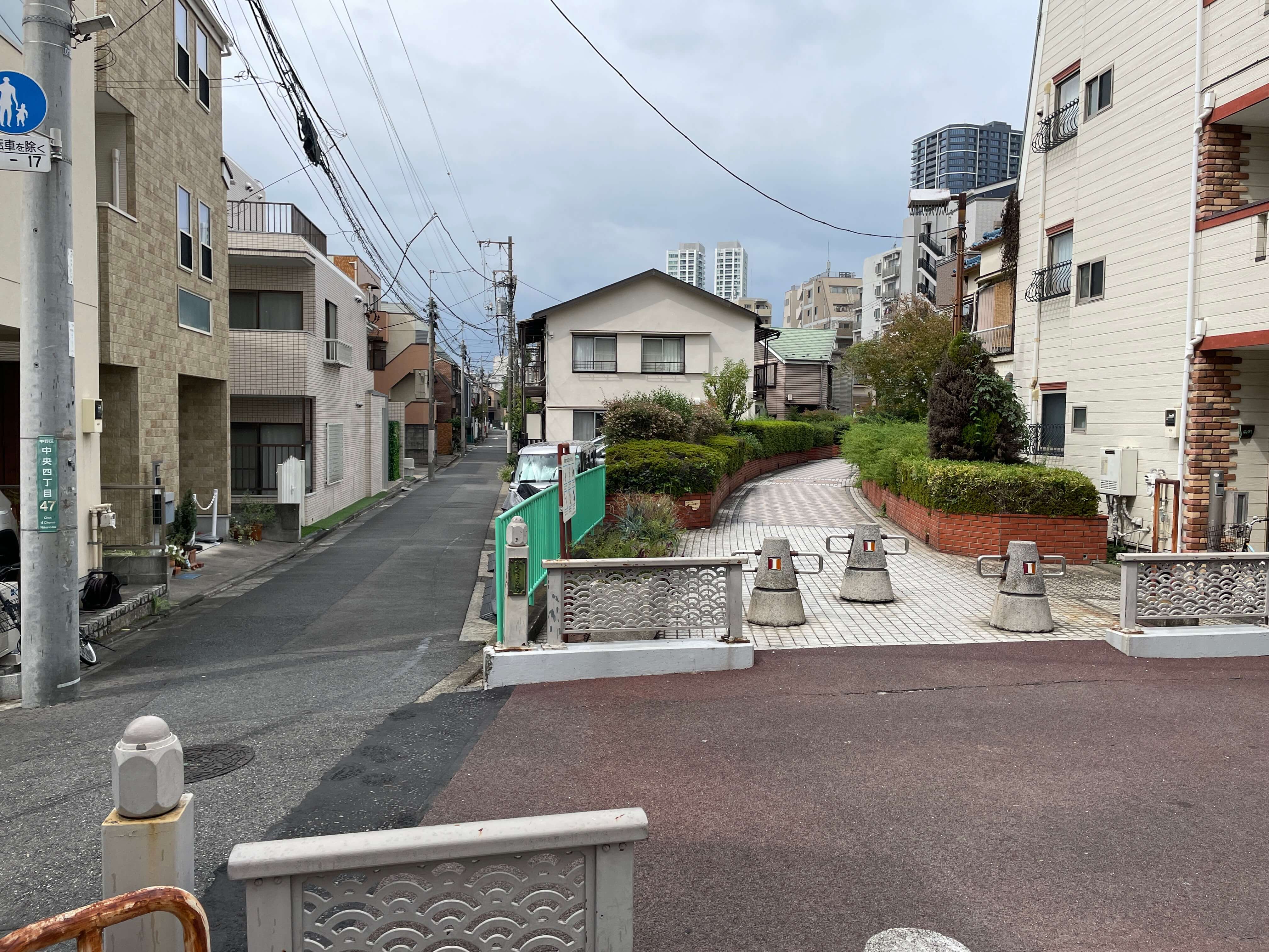
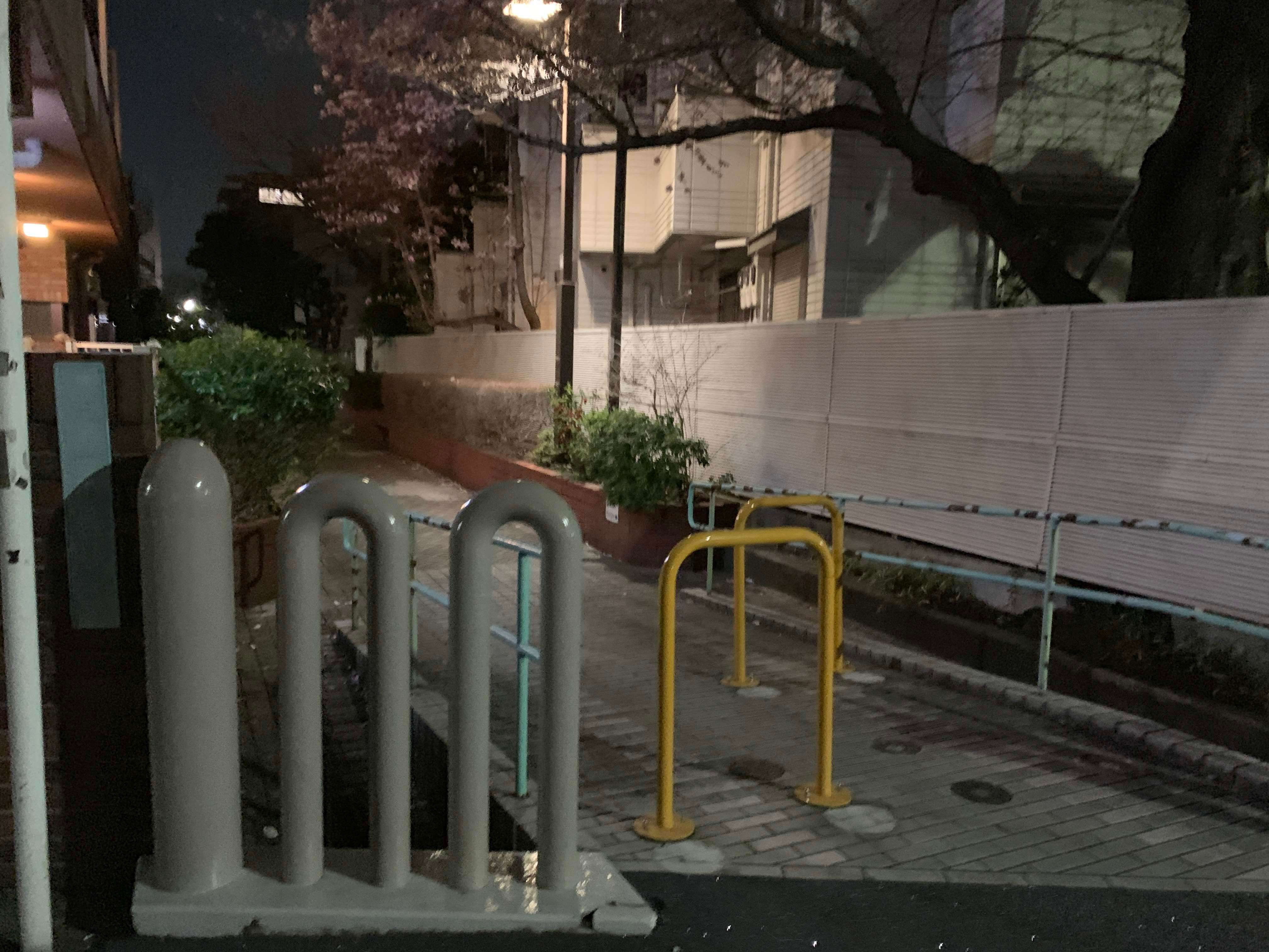
Culverts with sewage pipes buried beneath them are structurally not very strong. That’s why bollards are often placed at culvert entrances — they carry the vital mission of protecting the buried riverbed from heavy vehicles. Next time you come across a bollard by the roadside, give it a quiet word of thanks and check whether you might be standing on a culvert. You’ll also occasionally spot culverts marked with vehicle weight-limit signs instead — the reason is exactly the same.
A Small Exploration to Feel the River
Now that you’ve read this far — go for a walk. Beyond the obvious clues, you’ll notice subtle elevation changes, breezes flowing through narrow valleys, a gentle dampness in the air, and maybe even the faint sound of water from the drainage below your feet. A river you can’t see can still be felt in all these ways. A hundred explanations are worth less than one walk — even if the river itself remains out of sight.
